
October 6th, 2023
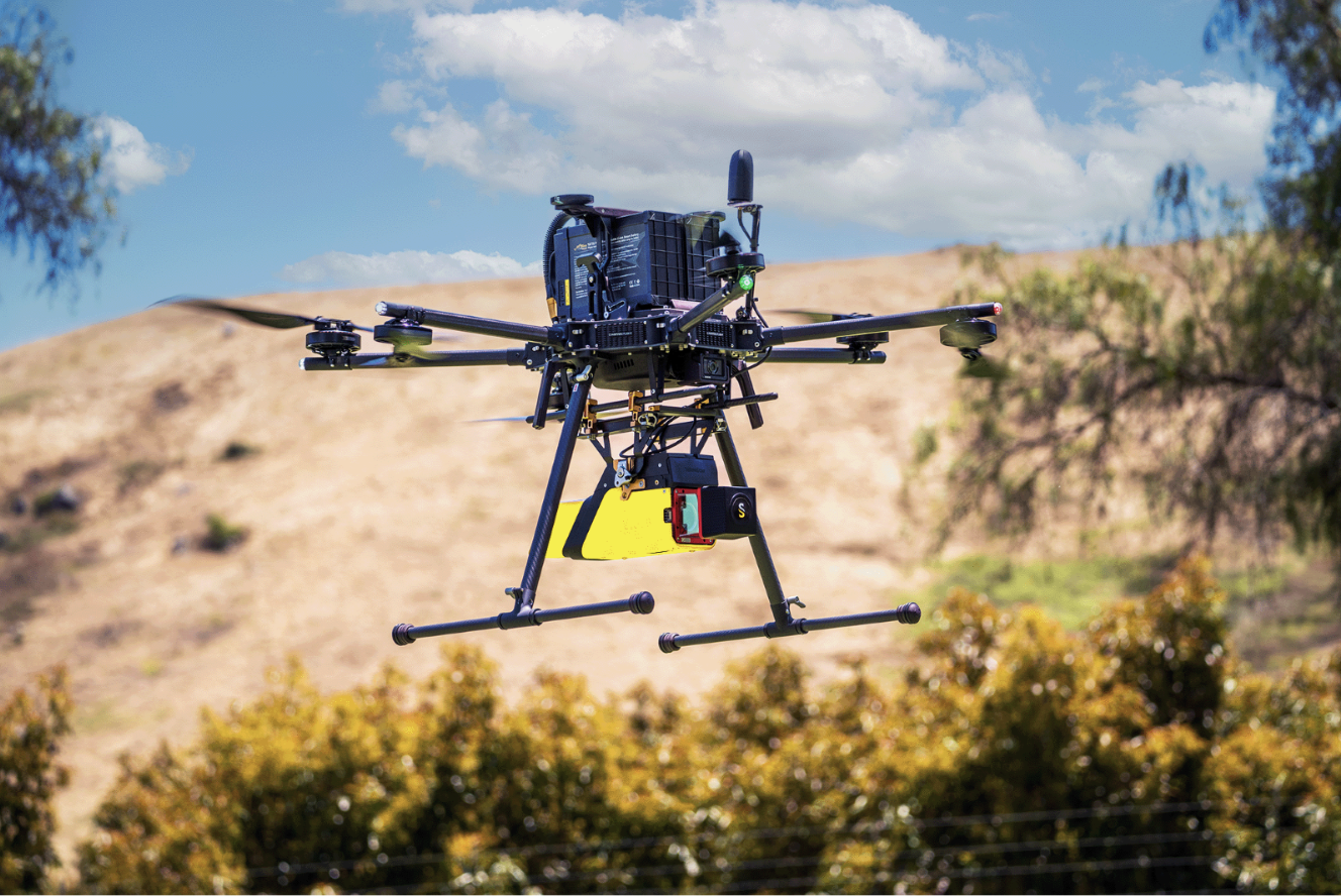
Integration: IF1200A
Solution: YellowScan Vx20-300
In recent years, advancements in small Uncrewed Aerial Systems (sUAS) technology have enabled the collection of accurate and rapid data for various applications. One such application is ground topography determination, crucial for a range of fields such as agriculture, urban planning, and environmental monitoring. This case study highlights the effective use of the YellowScan Vx20-300 sensor integrated with the IF1200A UAS, showcasing its proficiency in acquiring detailed ground topography data for a targeted area.

Accurate ground topography data is essential for understanding terrain variations, water flow patterns, and landscape characteristics. Traditional ground survey methods can be time-consuming and may not cover large or inaccessible areas effectively. The challenge was to acquire high-resolution ground topography data swiftly and accurately, enabling efficient decision-making for various commercial applications.
The Vx20-300 LiDAR solution was mounted on the IF1200A UAV for data acquisition. The IF1200A was programmed to fly at a velocity of 5 m/s and a height of 85 m, covering a designated area of 45,000 m² within 10 minutes.
Flight Velocity: 5 m/s
Flight Height: 85 m
Flight Time: 10 minutes
Survey Area: 45,000 m²
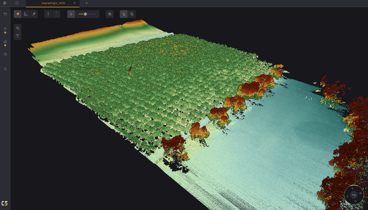
Data Collection Process: Trajectory refinement, point cloud generation, strip adjustment, ground classification

The mission yielded highly successful results:
Swift Data Collection: The entire process, from trajectory refinement to ground classification, was completed in less than 30 minutes, thanks to the efficiency of the IF1200A and YellowScan system.
Accurate Ground Topography: The Vx20-300 sensor demonstrated excellent vegetation penetration capabilities, providing clear data on ground topography. This allowed for the creation of accurate DTMs, DSMs, and DHMs.
Quick Data Processing: The collected data was processed efficiently due to the use of rapid ground classification techniques. This enabled the generation of relevant models for analysis.
Real-world Applicability: The obtained ground topography data proved valuable for various applications, including urban planning, hydrological modeling, and landscape assessment.
"The YellowScan CloudStation software they provided was very intuitive to use and made post-processing the data a breeze to get maximum value out of the point cloud models."
Casey Viera, Inspired Flight Operations Fleet Manager
In conclusion, the deployment of the YellowScan Vx20-300 LiDAR solution on the IF1200A UAV showcased the effectiveness of modern UAV technology in obtaining accurate and rapid ground topography data. The combination of quick data acquisition, sensor capabilities, and processing techniques highlights the potential for UAVs to revolutionize traditional survey methods in various industries.
With over 30 minutes of flight time, the IF1200A can cover large areas with minimal down time. Combined with the Yellowscan CloudStation software, stitching multiple flight plans together and processing data results in a quick and easy work flow to maximize efficiency, allowing the end user to analyze the results of the data sooner and spend more time interpreting an accurate model.